The best hikes in Gran Canaria
Gran Canaria is a great location for hiking. And from what we saw on the roads it’s very popular with cyclists, too. There were so many walks we would have done if we had the time. But instead we had to settle on some of the main attractions. These were our favourite hikes in Gran Canaria.
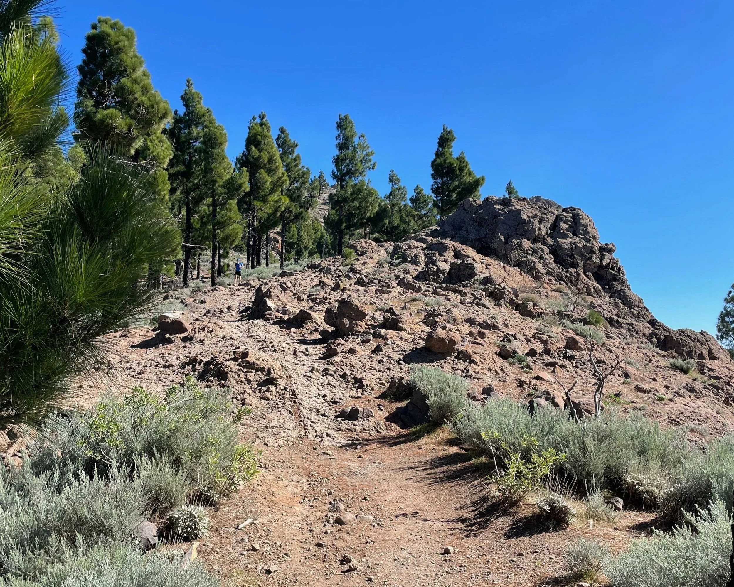
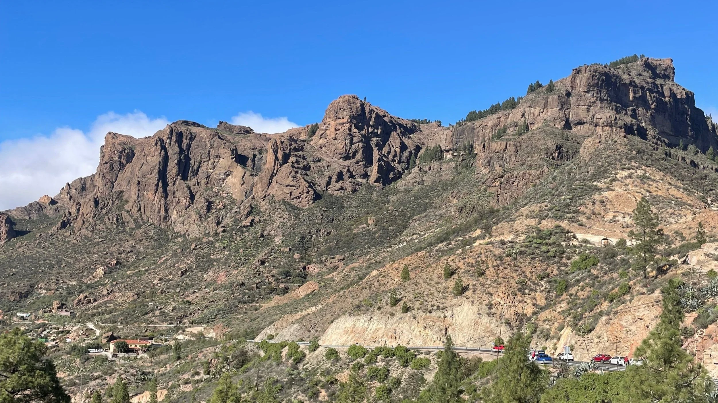
Pico de los Nieves
One of the most popular hikes in Gran Canaria, the views from Pico de los Nieves are stunning. We parked at Llanos de la Pez and walked clockwise along the hiking trail. There’s an optional extra stretch up to the view point at the very top, which is well worth taking. It boasts views of Morro de la Agujereada, highest point on the island. While the view from the ‘top’ of the Pico de los Nieves trail isn’t quite as impressive. This is fine if you want a shorter route, though.
The hike was 4.81 miles and took us 2:45, including stops for photos, food, and water. The route was mostly through pine forests. And while this is a brilliant hike, the first half is entirely uphill. We chose to go clockwise, with a steep but shorter first half. You could also take the slow and steady hill to the peak anti-clockwise.

Roque Nublo
From Pico de los Nieves we drove to Roque Nublo. There is a small designated car park, but we parked on the road, which was busy even in the late afternoon. From here, we walked up to the rock… Which is actually more impressive from further away. But it’s still worth the trip!
Tired from our earlier hike, this 2 mile walk took 1:10 in total. Although if you walked straight up and back with no exploring it would be much shorter. It made sense for us to fit these two stops into the same day as we’d missed a chance to hike Pico de los Nieves the week before due to clouds.. But if you’re not up for two hikes in a day, albeit one fairly short but steep uphill walk, separate these into two days.
Tunde
Gran Canaria has very varying weather. In the south we didn’t see rain for a full three weeks (until the day we left!) but the north has quite a different climate with more clouds, wind, and drizzle. Our first attempt at Pico de los Nieves had us driving straight into a cloud and the forest was wet with no views. So we drove down to Tunde and did a circular hike in the valley there, which we found on AllTrails.
This hike varied between green, rocky, and forest landscapes and took us 1.5 hours to cover 2.9 miles. Though there was quite a bit of uphill, this was a much easier hike than Pico de los Nieves.

Finca de Osorio
A peaceful farm located between Teror and Firgas, Finca de Osorio has a number of walks mapped out for visitors. We walked the red route, which took us just under an hour. The walk takes you around the grounds of this peaceful farmland and is about 2 miles long. There are some short uphill areas, but I did this walk in slip-on sandals and had no trouble.
There are shorter walks and plenty of gardens to relax in at Finca de Osorio. And it’s a lovely place to rest on a warm afternoon. We visited after lunch in Teror, and before a trip to Firgas. And it was easy to fit all three spots into one day with plenty of time to wander without rushing.
Want to know more about Teror, Firgas, and other places to visit in Gran Canaria? Read our blog.

Güigüí
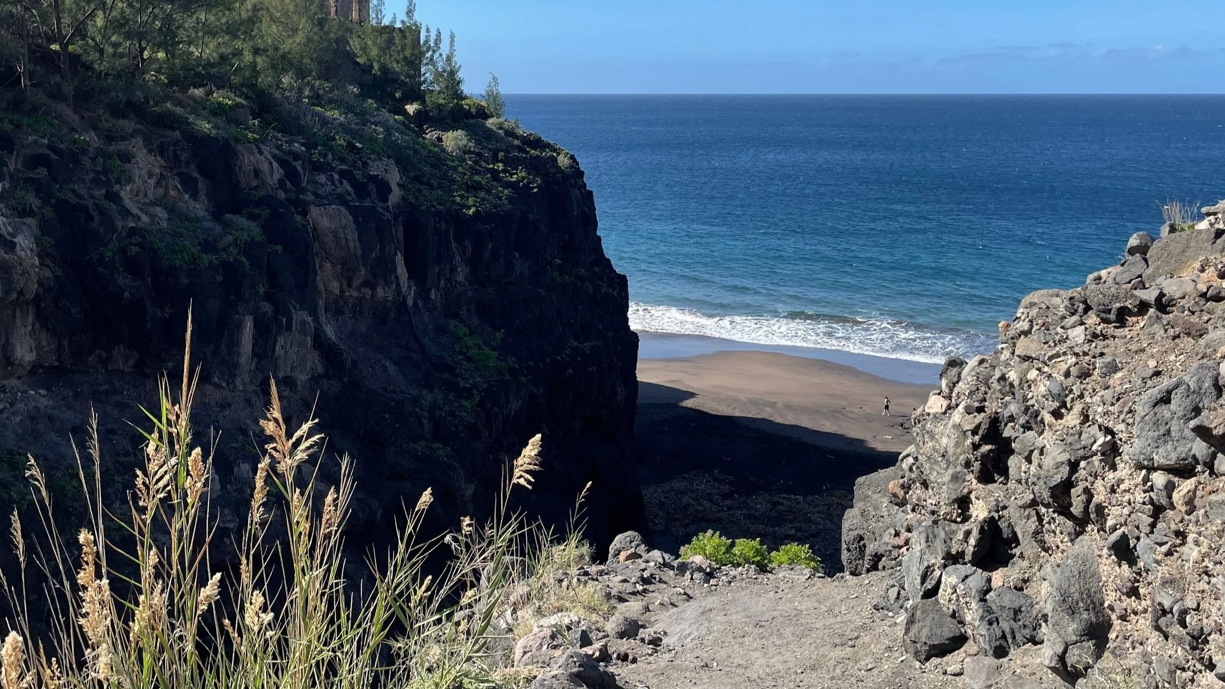
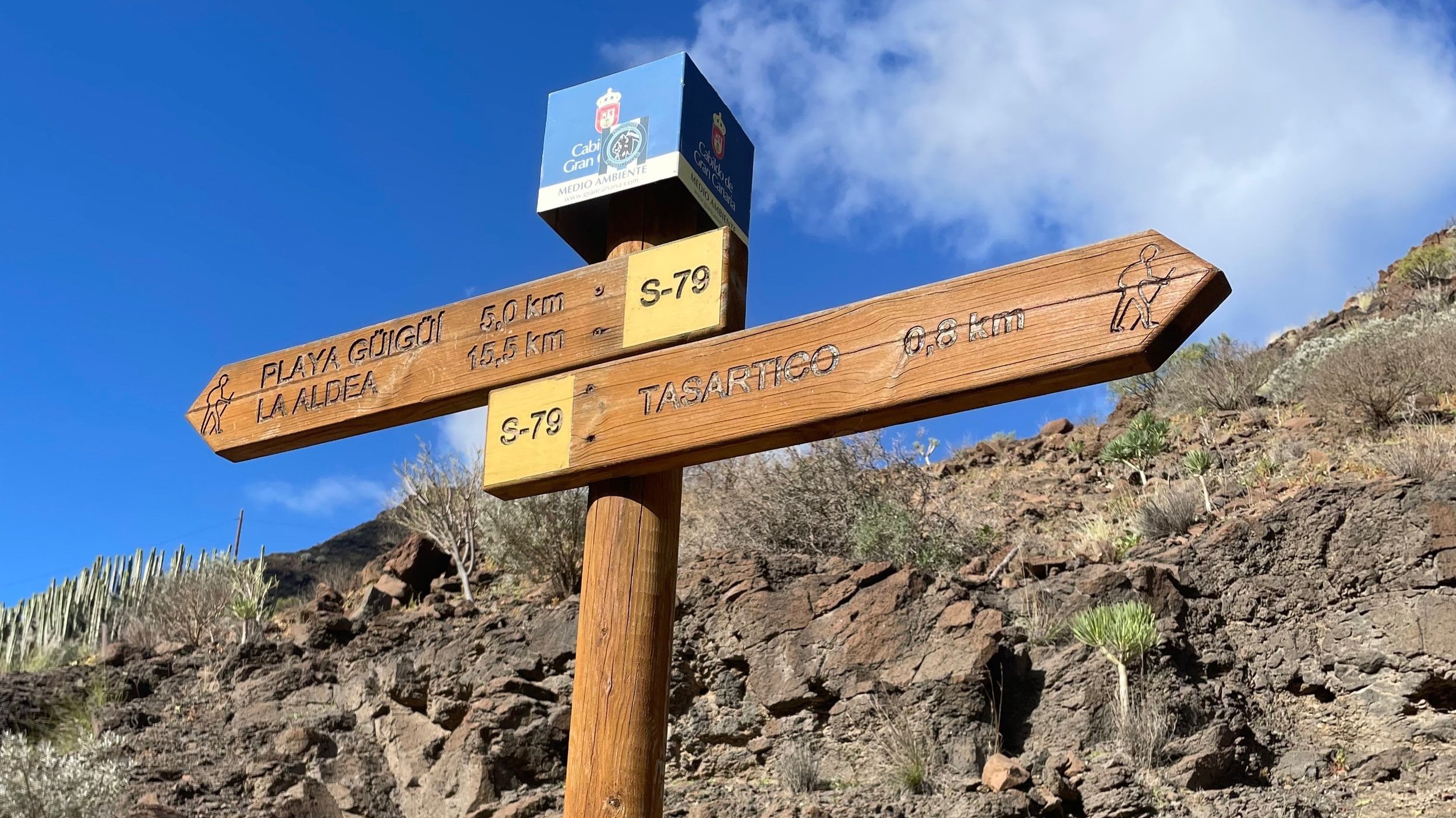
When planning our trip to Gran Canaria, we weren’t sure if we would have time to fit in Güigüí, which ended up being our final hike. Playa de Güigüí is a ‘secret’ beach on the west coast of the island, and from what you read online the walk there can sound daunting. But I’m so glad we did it.
For a full run-down of the hike to Playa de Güigüí, what the route is like, and more, check out our blog here.
This might be not just my favourite hike in Gran Canaria, but one of my favourite hikes ever. And although it is hard, I’d definitely recommend it if you’re up to it.
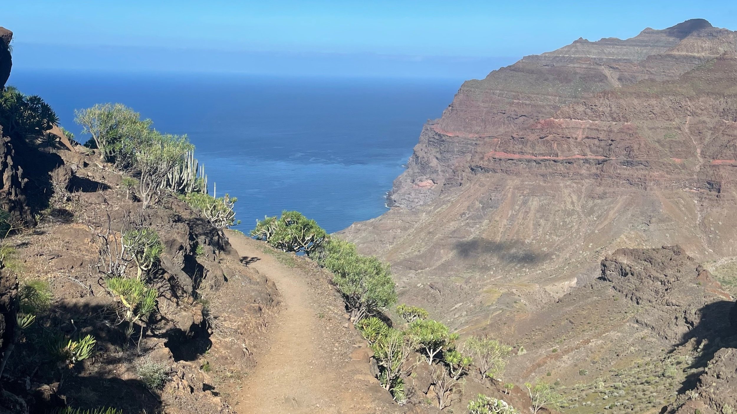
The hike to Güigüí
Popular with campers, this totally remote virgin beach is surrounded by cliffs, and is accessed by a 5km hike each way. We parked at Tasartica and the hike to the beach took us 2 hours including some breaks for photos, water, and catching our breath. The journey back took 2:15.
And if you prefer beaches without 5 km hikes, these are some of our favourites in Gran Canaria.
In the summer months, there are some guides that arrange boat journeys to Güigüí from nearby towns. While some hikers like to camp overnight on the secluded beach. And while this does sound idyllic, it also means a 5 km cliff trek carrying camping gear and overnight supplies!
The way to Güigüí is steep in the first half. Then once you’ve passed over the ridge it’s mostly downhill with some uneven terrain. The way back is less steep, but the uphill walk to the ridge is longer.
Though this walk isn’t one for the unfit or inexperienced hiker, there isn’t any technical difficulty involved in this hike. There are clear paths and no scrambles or climbs throughout the route. A level of physical fitness is needed to tackle the steep uphill with very little shade – especially in the summer months. So take plenty of water, pack as light as you can, and wear sensible shoes. Even in late November this hike was very hot… But the beach at the end was totally worth it.
There was a small shack open where a woman sells cold coke, lemonade, beer, and water. And we were lucky that she was open on our walk back to the car. But don’t rely on her being there when you take the hike – pack everything you might need to drink and more just in case!
Looking for more things to do in Gran Canaria? Check out our blog.